It’s a day to Celebrate

It’s Singapore’s national day, and we are celebrating it big time again. Yes, again, because I have come to realise that having the capacity to celebrate is not a given. We are so fortunate that this little red dot is free from many natural disasters. We may not be the best of the best, but we are certainly one of the better managed countries. The country’s stability in our daily lives allow many of us to dream big, to live our dreams or just to live life as it is.

Last week, I joined some friends at the Marina Bay Sands area to watch fireworks. Looking around MBS and the eventual lighting display, I am impressed. I am impressed by not just the display, more so that the entire Sands’ area was built to cater to such mega events. I recalled reading some news somewhere stating that the Gardens by the Bay was one of Mr Lee Kuan Yew’s vision, a vision to make Singapore a garden city. How different would Singapore be if our leaders had short range vision? How far ahead can we imagine? I am grateful for all that we have today, as a nation, we did well. As a citizen, we each have our own battle to fight, our own aspiration to fulfill. When our country gives us a peace of mind to live in, we know we have the space to think big, to imagine the unimaginable, to dream the wildest dream. Let’s celebrate our little success today and also to think about tomorrow, for tomorrow’s dream is built from today.

Sleepless Ultra

Image

Last October, I accompanied a good friend, Ivy, to run a short segment of the Monster Ultra 200. As the event title suggest, participants will run an ultra distance of 200km within 48hrs – with little or no sleep. While waiting for Ivy at Kranji MRT station, I saw a few “Monsters” ran passed me. It was not difficult to differentiate these “Monsters” from other casual runners because you can hardly see people running at 1am carrying a hydration bladder looking very determined. As I looked on, I sank into a state of reminiscing the days preparing for Everest climb. Back then, very often I went on long hours of run-jog-walk to build my endurance fitness. I know I can manage well with long hours of climb, trek or jog without much sleep, and that is the exact reason why Ivy got me to do this with her. I was to be her motivator to help her stay awake during the ungodly hours.

With Ivy on her "Monster Ultra 200". She was on her 50+km, I accompanied her for 30km. (Photo credit: William Muk)

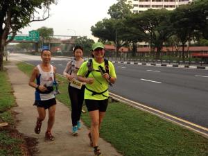
With Ivy on her “Monster Ultra 200 2014”. She was on her 50+km, I accompanied her for 30km. (Photo credit: William Muk)

William, a stranger then, run along with us to support Ivy's quest.

William Muk, a stranger then, ran along with us to support Ivy’s quest. (Photo credit: William Muk)

Throughout the run with Ivy, the supporting officials were very kind and helpful, despite me not being one of the “Monsters”, they offered me food and drinks. Along the way, we also met a runner who came specially to catch up with the “Monsters” running pass near his home; he “caught” Ivy the “Monster”. He had also paced Ivy for a distance after I left her. And today, we became friends.

I was basked into a very familiar atmosphere – a community that support and encourage one to push boundaries, to test personal limits, to persevere, to outdo oneself. I told myself, I want, and I must do this again. Then, I found out about Twilight Ultra Challenge (TUC) 2015. I had previously known about this event (held for the past 4 years by the same organiser), I was just too busy climbing mountains that I had not a chance to think about participating. On the other end, I have a group of secondary school friends starting to pick up running to keep fit. I thought it would be a good opportunity for my secondary school friends to take part in a local event that is no frills, and a chance to try out longer distances . Shared my idea with them, and yippee, we have a goal! We had about 4 months to prepare.

We organised running session together, and increase our running distance progressively. But we didn’t manage to clock enough mileage before the event, as a group, we ran up to 14km – nothing close to ultra, not even a marathon distance. I was worried. The only consolation I have is that TUC allows you to run as long or as short a distance as you can manage (or as you wished) in 16 hours. This is also probably the reason why school mates are willing to try knowing that they have little experience with ultra distance running. We signed up as a team, not a solo runner, this gave them lesser stress.

The day came, and I set a target for myself – 45km. Since TUC is an ultra event, I see it as necessary to clock at least a marathon distance, and 45km is a decent ultra distance. *Grin* (Ultra distance is running and walking longer than the traditional marathon length of 42.195 km).

20150328_184052

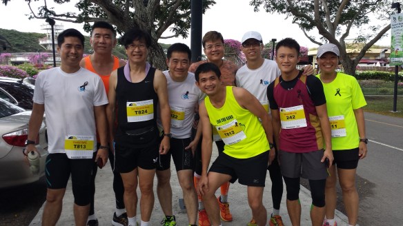
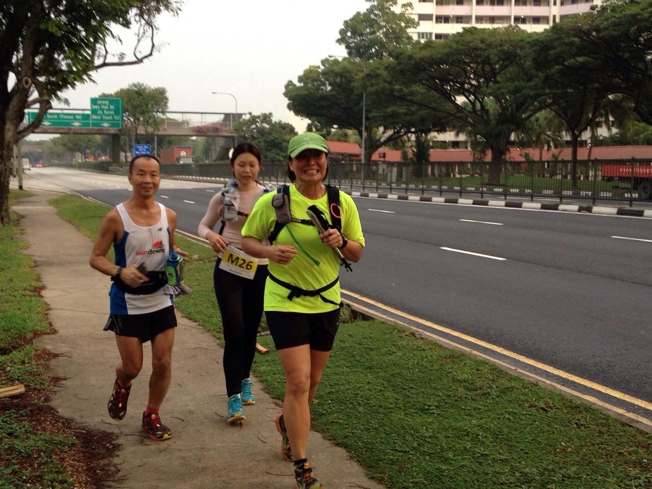
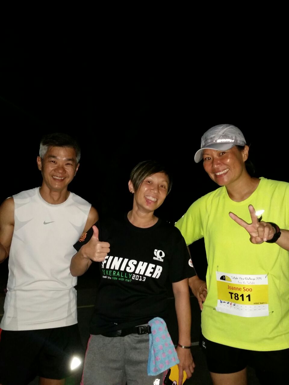
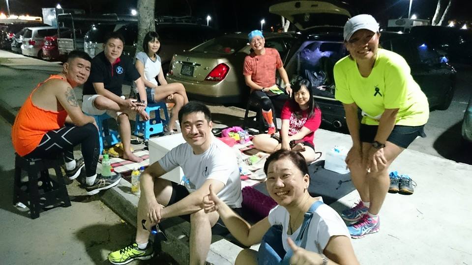
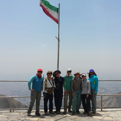
My secondary school mates, junior, seniors, all ready at TUC2015. (Photo credit: Michael Chia)

Before the flag-off at 7pm, we observed a 91 seconds silence for Mr Lee Kuan Yew. Among the runners, some have pledged to run 91km (the late Mr Lee’s age), some to run 50km for SG50. I stick to my 45km target, focus on it, and would review depending on my condition.

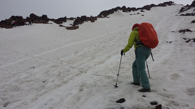
I was doing well for the first 15km (3 loops of 5km); when I was on my 4th loop, my legs started to feel jelly, an early sign of muscular fatigue, and pain also set in – my ITB was acting up causing pain in my right knee and my right groin. I started to limp, and I had difficulty bending my right knee and to raise it up to 90 degree. It was obvious to me that this was caused by a lack of running mileage + a long-standing ITB issue. I started to doubt if I could complete at least 45km distance. While I had doubts, I also started to find ways to alleviate the pain, and of course to fight off that jelly legs.

Elevating my legs

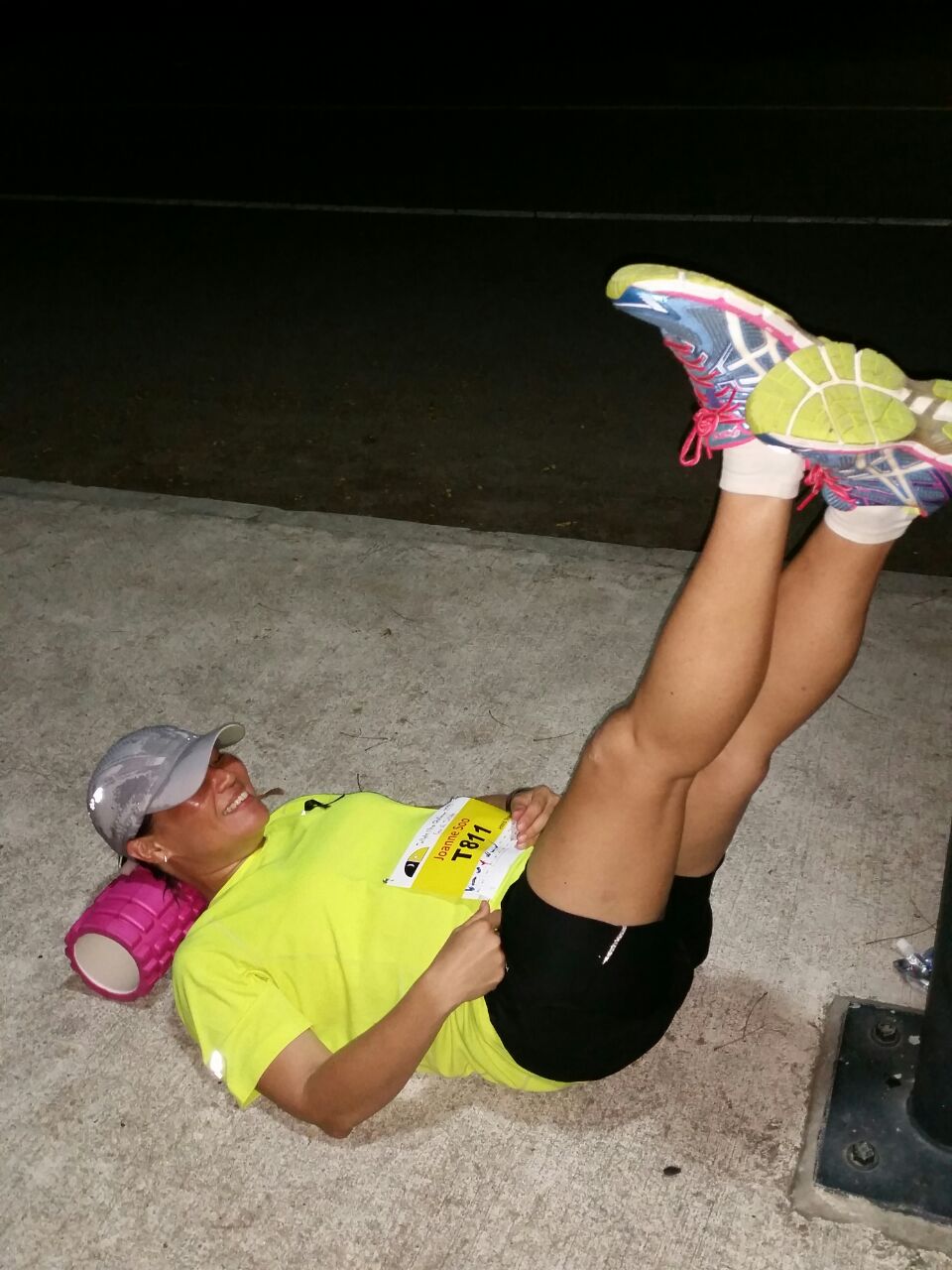
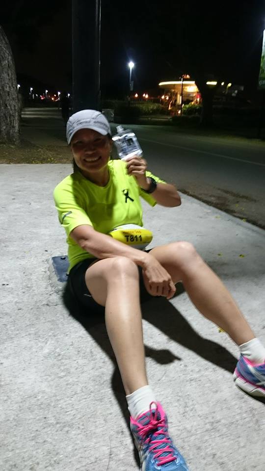
Elevating my legs 10-15mins for every 5km I ran (Photo credit: Jacqueline Oon)

I have good mountain fitness, but extremely lacking in running mileage. It was literally a game of mind over body – mind over dead legs! I stopped at every 5km to do stretches and spent 10-15mins elevating my legs. It proved to be helpful, and it worked! It worked for the next 15km, at least. It also helped when a couple friend came to pace me for 2 loops of 5km.  I managed to struggle a walk-a-jog and had completed 35km at 2:30am. I took 7.5 hrs just to complete 35km. I felt so inadequate because I used to be able complete a marathon in 6 hours. To keep my legs going, and to stay away from remembering the pain, I kept repeating a quote I chanced upon in the internet: Pain is weakness leaving the body. As I repeat my mumbling, it went:

11053280_10153149278988550_2373097841323037692_n

Diligently taking in high energy supplementary meals like Weider Royal Jelly. My fav! (Photo credit: Adeline Kea)

Pain is weakness leaving the body

Pain is weakness leaving my body

Pain is weakness leaving their body

Pain is weakness … “mind went blank” … argh

Pain is weakness leaving my body

Pain is weakness leaving the body

Pain is my body ……… pain is hell!

Pain is a sensation can be ignored!

Pain is a sensation can be ignored!

Pain is a sensation just ignore!

Pain just ignore …omg

Pain is idiot…….pain is …..

IMG-20150328-WA0042

Mak and Beeli (middle) paced me for 10km, helped me to complete 35km distance at about 2:30am. (Photo credit: Jacqueline Oon)

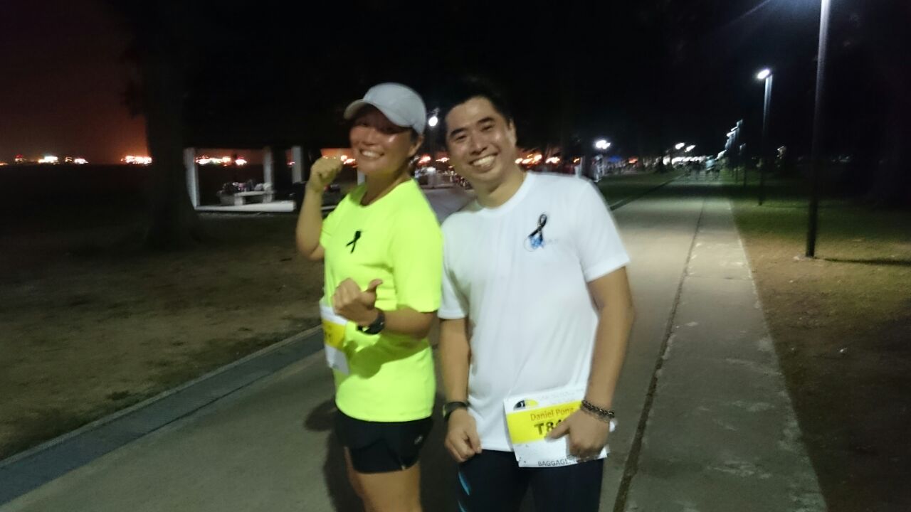
After completing 35km, my legs were totally spent. I took a 30 mins break and continue to elevate my legs. By now, half of my team had gone home after completed 30km. I walked the next 5km with Daniel Pong and Jacqueline Oon (who came to give us support), and that 5km walked has helped to release the fatigue in my legs; that left me with another 5km to reach my target distance. Yippee!

IMG-20150328-WA0037

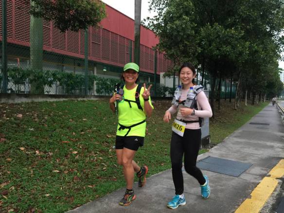
Daniel and I walked for 5km, it helped to release the fatigue in my legs. 40km for me, and 30km for Daniel – a first for Daniel, his longest recorded distance was our 14km training run. (Photo taken at our first 10km, credit: Adeline Kea)

By the time when I completed 45km distance, all my team mates had gone home. I was then left alone with the rest of the runners who were still accumulating distances. I have decided to jog another 5km to make it to 50km for SG50. It was an easy decision then, because the fatigue had gone (the soreness came back at the next 10km). At pre-dawn hours, runners who were still on the course were battling their own challenges, some were running strong (yes, run!), some were walking like a zombie. It was very encouraging and comforting to hear call-outs from other runners, some gave a wave, a nod or a thumbs-up which was equally motivating.

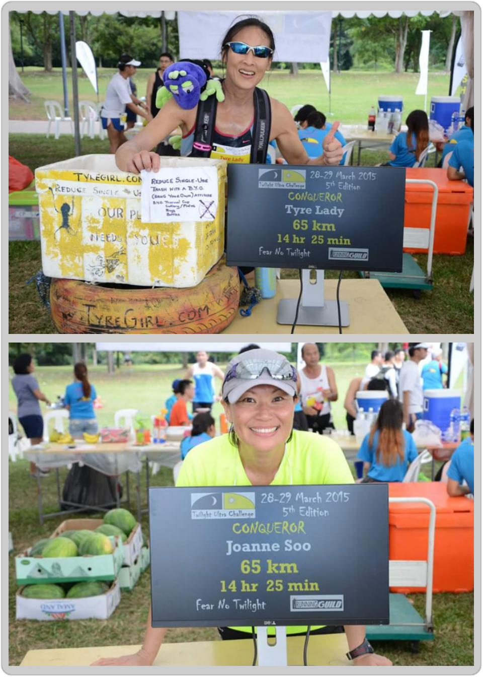
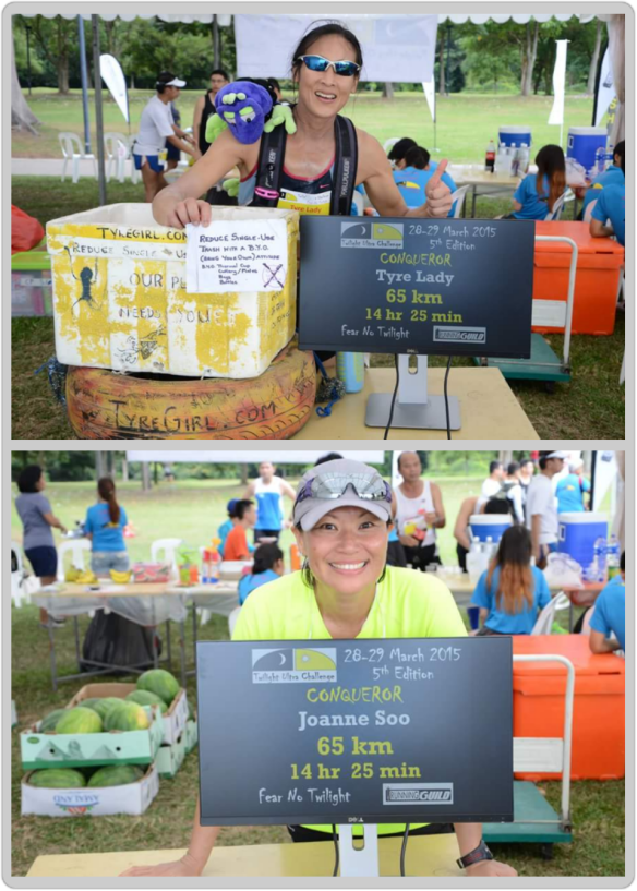
While on my way to complete my 50km, I met Rima, popularly known as the Tyre-Lady Ice among our local running community. Rima is a long time friend, we have done crazy stuff together, including partnering her to run her first marathon with a tyre here in Singapore! I asked her what distance she planned to complete, as I knew that she must be already going for her 55th kilometers. She said, “65km, the year Singapore became independent!” I paused for a second before saying: ” I will probably stop at 50km”, and she continued, “Hey, how about you aiming at 65km too?” I rolled my eye ball for 360 degree, took a deep breath, gave a smirk and said: “OK, I will try!”. We went on our way. Self-talk moments emerged again: “Do I want a new target!?”, “Can I do it?”, “How’s my legs now?”.  I coaxed myself: “It’s only another 15km”, “3 x 5km”, “I am coming this way one more time, just one more time!”. With my pace, I knew I would need another 3hrs to complete the next 15km. As I plod along the very familiar East Coast Park, deep in my heart, I knew I had already bought the idea sold by Rima; the self coaxing was unnecessary.

The next 10km was a cocktail of emotions – felt crazy, at times a little satisfied, then had regrets when in pain, sometime happy sometime silly – the only time that broke the momentum of those emotions was when fellow runners called out with words of encouragement – “Keep going”, “Stay strong”, Keep it up”. Oh my, I was so looking forward to all these voices and words. Never undermine simple words of encouragement; for me, it was rejuvenating, and faith restored! When I crossed path with Rima again, she offered to wait for me to complete the last 5km together. It was really very generous of her to do that. And so, a little bit of eagerness to want to quickly catch up with Rima.

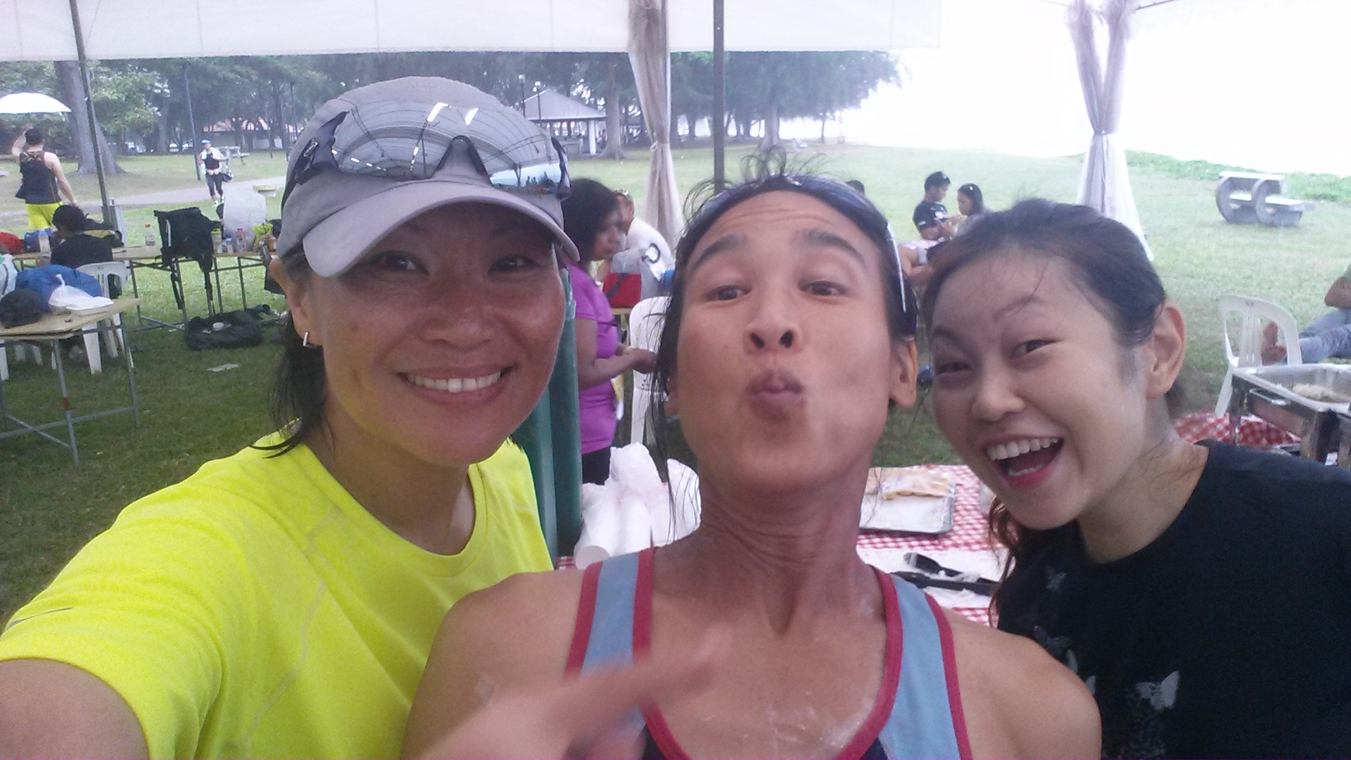
Finally I met up with Rima, and we started to walk and chat. She is really a honey! Almost all runners who passed her would waved or Hi-five to her. She is everyone’s friend. That’s Rima, and that’s what makes her attractive. We completed our last 5km walk-a-jog together under the morning sun with all the “Hellos” and “Hi-5s”; and of course, Rima’s “ka-chang” that reflects her efforts to reduce trash. (“Ka-chang” – cantonese word for personal belongings or tools)

IMG_0153

(Photo credit: Mr Ben Swee / TUC2015 Organiser)

At the event site, spotted Ivy arriving to help out at the event. And this is also the first time that we turned our roles around – I am a participant, while she is a volunteer.

20150329_103718

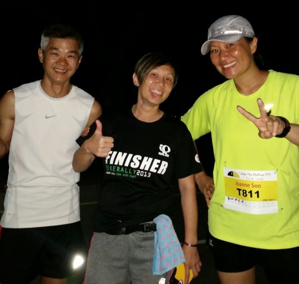
With Rima (middle) and Ivy at the TUC event tent.

My Appreciation

Thanks to my fellow school mates who joined me for this event. Ben, Daniel, Michael , Andrew, Robin, Chang Pin, Guann Hwa 学长. Also my appreciation to fellow Alumni who came to support us with drinks and food – Adeline Kea, Jacqueline Oon, Anston Tan & wife, Nancy Goh, Shirleen Phua.

11041666_10153149279368550_6276528948499457519_n

Hua Yi Alumni (Photo credit: Adeline Kea)

Thank you to the organisers and their volunteers, they were awesome. The team at the check-station were forever so alive. Some of the kids even brought their books to study. I love the splashing of ice cold water. I like the idea of BYOB – Bring your own bottle. Though I did not eat much of the food provided (I took 2 slices of peanut butter bread), I saw that there were good selection of food provided, including marshmallow!

There were runners who gave good morale support. In particular, tag no 203 (Ms Esther Yong) – she never failed to give a thumbs-up or some words of encouragement. Each time I passed her, I felt as if I was seeing a long time friend, and I look forward to cross path with her. That gave me some motivation to keep moving; and tag no 11 (Mr Daniel Ong), this one was a power house. His words was with zest and gusto – “Stay strong”, “Keep going” … Little things like this meant a lot.  Thank you.

Mak and Beelie for so willingly to jog with me, jog at my snail pace for 10km at some ungodly hours where they could have gone home to rest. Jacqueline Oon for walking the 5km with me and Daniel.

My dear friend Rima, who encouraged me, and waited for me to complete the last 5km together. Making it less lonely and less painful.

20150329_102611

Raudhah completed 95km.

Raudhah! Her gentle suggestion of completing a minimum ultra distance helped me set my target early. Or else, I would have chosen to “complete as far as I can go” which could be a 20km distance when my legs were complaining. It shows that having a goal is just so important; and having a friend to remind you about your goal is priceless!

My Reflection

Ultra Distance for the unprepared
Running an ultra event is no joking matters. Though I may not have sufficient running mileage for TUC2015, I had previous experience dealing with long distance running and staying up with little or no sleep. I have walked/jogged for up to 40 hours with little sleep, completed three 100km walks, ran at least five marathons. More importantly, I am currently active with my mountain climbing activities, so I have not entered the ultra event with zero fitness. I will advise against entering an ultra event without proper preparation, you either get badly injured physically, or you might just bruised your own ego – either one is bad. For those who are keen to move into doing ultra races, do your homework – read up, and enter a race where organisers provide meaningful support during the race, and offer some form of advise to how you can prepare for it.

I do not have sufficient running mileage to start with, I have to recognise it and be realistic with my target. Having attempted long distance running prior, I know that I will be able to complete 45km in 16 hours; the additional 20km is a bonus. Though the timing I took to complete 65km is nothing really impressive, I am satisfied and feel accomplished. The follow quote relates well with the ultra event:

“If you can’t fly then run, if you can’t run then walk, if you can’t walk then crawl, but whatever you do you have to keep moving forward.” – Martin Luther King Jr.

Choosing an event to participate
The Twilight Ultra Challenge is the 2nd local ultra races that I ever took part in; my first ultra race was MR25 Ultramarathon. No frills is what I like, I don’t need t-shirts, medals and all the fanciful banners/backdrop because they meant little to me. TUC allows optional purchases, which is a brilliant idea. What matters to me most is the experience and interaction that I will have with myself, and the people involved in the event. Small scale events like this allow us to make new friends. There is a quote that goes – there are no strangers here, only friends you haven’t met. That is so true!

We signed up as a team, and here is our accumulative distances:

HYAS Team 1 – 155km

Ben – 30km

Robin – 30km

Daniel – 30km

Joanne – 65km

HYAS Team 2 – 130km

Chang Pin – 40km

Andrew – 35km

Guann Hwa – 25km

Michael – 30km

Would I do it again? Yes, I will, just don’t know when.

To the Roof of Africa and back

Re-post from http://aceadventure.org/

“So far the evidence that we have in the world points to Africa as the Cradle of Humankind.”
George Abungu, Director-General of the National Museums of Kenya.

It is in Africa that the oldest fossils of the early ancestors of humankind have been found, and it is the only continent that shows evidence of humans through the key stages of evolution. source: http://www.bbc.co.uk/worldservice/africa/features/storyofafrica/index_section1.shtml

Mt Kili signboard

Africa is the world’s second largest continent; the largest continent is Asia. The highest point on Africa is the Uhuru Peak at 5,895m above sea level in Tanzania, also known as Mt Kilimanjaro, and widely acclaimed as the Roof of Africa! Mt Kilimanjaro is a popular peak – it is not only the highest peak in Africa, it is also one of the Seven Summits (the highest peak of each continent). It is with the aim to climb Mt Kilimanjaro that brought me, and five other female trekkers, to Africa. As a first timer visiting Africa, I am intrigued by the fact that I am visiting a continent where human life first began. While the continent is still prone to all ills of humanity, I believe that an open mind will lead me to experience a new Africa.

We flew in to Moshi where Kilimanjaro International Airport (KIA) is located. Before KIA opens more international flights to the world, tourists typically fly to Nairobi (Kenya) and take a 8hrs bus ride to Moshi. It is also possible to fly to Dar es Salaam (the largest city in Tanzania) and take a 7hrs bus ride to Moshi. As flying direct to Moshi is likely to be more expensive, tourists who want to save air flight cost can trade it with a bus ride (though I do not think it is a worthy trade off).

Visit where the locals will visit!

Visit where the locals will visit!

We arrived in Moshi in the early afternoon after 2 transits covering an average of 12hrs flight time. Tanzania is about 5hrs behind Singapore time; 12pm in Tanzania will be about 5pm in Singapore. We spent the remaining day resting in the resort. The next day, we visited Moshi town, about 20mins drive from the resort. The supermarket in town is quite similar to those we have here in Singapore.

You can buy mineral water from the supermarket, it is definitely cheaper than to buy it from the resort where we stay. It is worth to change some Tanzanian Shilling (TZS) to make purchases in a local store. Some shops/restaurants accept US dollars but it will be based on their exchange rate which can be really high.

Team members of the IWD Kilimanjaro Challenge

Team members of the IWD Kilimanjaro Challenge

The following day, with much anticipation, we got ready to start our 8-days trek on Mt Kilimanjaro. We have prepared for the trek for almost six months; it was time to face the real challenge. We took the northern circuit which offered excellent views from all sides of the mountain, including the quiet, rarely visited northern slopes; a journey that covered 95km on foot, trekking from an elevation of 2,000m to 5,895m. 

Expedition support crew were getting ready to weigh their expedition loads in an orderly manner

Expedition support crew were getting ready to weigh their expedition loads in an orderly manner

We arrived at the Londorossi Gate (2,250m) by vehicle. This is the place where we saw the support crew of various expedition groups gathered to sort out the logistics and distribution of loads. It was conducted very orderly, and impressively efficient. After another 15mins of drive, we arrived at the Lemosho Gate – we bid good-bye to our vehicle commander and were all ready to embrace the beauty of the African forest and the mythical of Mt Kilimanjaro.

Sign-in at Campsite

Sign-in at Campsite

The first day of our trek saw us trekking through the rain forest zone; on the second day, after an hour leaving the campsite, the trail led us to a lower alpine zone trekking in an average elevation of 3,000m above sea level. The slopes were gradual, and hardly any steep ascent.

After 3 days of trekking, we arrived at Moir Hut which is at an elevation of 4,200m. It was from here that we felt the thin air taking a toll on our body. We took a short acclimatization hike to 4,370m then return to Moir Hut to rest for the evening. 

First view of Mt kili

Our first “WOW” moment view of Mt Kilimanjaro from the lower alpine zone

After leaving Moir Hut, we entered the northern circuit camping at Buffalo Camp (4,150m), and then moved on to Third Cave. Third Cave campsite is officially recorded at 3,800m, however, my altimeter read 4,050m. The air remained thin, we were careful not to exert unnecessarily. 

The team arrived at the Third Cave Camp in high spirit

The team arrived at the Third Cave Camp in high spirit

From Third Cave campsite, we trekked another 10km up the moraine slopes to School Hut at 4,800m. We were already experiencing breathlessness as we trek up the incline slopes; by then, we have moved on to a high alpine and glacier zone. We had already spotted Mawenzi Peak, standing proudly from a far distance to the south-east since the day we trekked to Baffalo Camp, it felt closer as we approached School Hut. Mawenzi Peak is the 3rd highest peak in Africa, Mt Kenya (Kenya) is the 2nd highest. 

Mawenzi Peak (5149m), the 3rd highest peak in Africa

Mawenzi Peak (5149m), the 3rd highest peak in Africa

School Hut Camp at 4800m

School Hut Camp at 4800m

We made our summit climb from the School Hut, leaving at about 12am after a light supper. The first 2 hours was a gradual slope, after about 4-5hrs, the climb became steeper as we approached Gilman’s Point (5,685m).  From Gilman’s Point, we trekked along the crater rim that led us to Stella Point (5,756m), and from Stella Point, it would be about an hour to reach the Uhuru Peak.

Gilman's Point at 5,685m

Gilman’s Point at 5,685m

Stella Point at 5,756m

Stella Point at 5,756m

Uhuru Peak – 5,895m (Summit of Mt Kilimanjaro)

Uhuru Peak – 5,895m (Summit of Mt Kilimanjaro)

After our summit climb, we descent to Millennium Camp to rest. The following day, which was the 8th day of our trek, we descent to Mweka Gate. We ended our 8 days’ climb on Mt Kilimanjaro in high spirit but a tired body. In summary, the trek got tougher each day as we gained elevation and the thin air made breathing difficult on slopes causing each step heavier than the last. It was challenging for everyone, especially so that all the other ladies were climbing beyond 4,000m for the first time.

Apart for the scenic environment around Mt Kilimanjaro, the support crew who supported us the whole time had made our climb memorable and certainly felt like a queen in African style. 

Team at Millenium Camp

Post Climb Thoughts

The climb to the summit is not as technically demanding as when climbing the peaks in the Himalayas or Andes; but the high elevation, low temperature, and the occasional high winds make climbing Mt Kilimanjaro a difficult and dangerous attempt. An itinerary cater for acclimatization is essential, even the most experienced trekkers may suffer some degree of altitude sickness. The highest point on Mt Kilimanjaro is at an altitude which may cause water retention in the lungs leading to high altitude pulmonary edema (HAPE), or swelling of the brain – high altitude cerebral edema (HACE).  All trekkers will suffer considerable discomfort, typically shortage of breath, hypothermia, and headaches.

On my journey to the top plodding at an elevation between 5,700m and 5,800m – an elevation that is not new to me – my heart was working laboriously. Very often when we focus so much on keeping a pace, we often neglect that we may be pushing ourselves harder than necessary. It strike me that I am not immune to any high altitude risk, I too may be susceptible to a sudden cardiac arrest at high altitude. I began to slow down my pace; giving my heart a break, focusing on exhalation to slow down my heart rate.

Sammi Teh

Sammi Teh

Sammi who has only been up to 3,200m before climbing Mt Kilimanjaro was hit by altitude sickness that caused her to sink into fatigue earlier than expected. She recounted her thoughts on trekking above 5,000m for the first time. “I felt helpless, confused and kept questioning if there is any limit to the power of ‘mind over body‘ at that elevation; I knew that my body was tired, yet my mind remain determined.”

Liyana Low

Liyana Low

The youngest among us is Liyana, and being young did not make her climb any less strenuous. She said “I was tired from the lack of oxygen – every step grew heavier. But each step I took was one step closer to the top, and that was what kept me going. Celebrating my 27th birthday at the top was the icing on the cake!”

Dominique caught flu and had fever the day when we trekked to Buffalo Camp. She managed to recover a little after taking a cocktail of medicines like anti-histamine, Panadol. She weren’t ready to give up yet. She recalled the midnight summit push that we took on a full-moon night “At

5,000m, you feel the biting cold in your bones. Your fingers and toes are numb. Breathing

is difficult, you are drowsy, and your eyes are half-closed. Each step takes a huge effort

Dominique Low

Dominique Low

and muscle in your body tells you to stop. Then you hear a voice – one step at a time, if your mind is willing, your body will adapt – I stop to blow my nose, drink more water, take a deep breath then keep on walking.”

Veronica Lim

Veronica Lim


Talking about cold, Veronica has it all ready to battle it. From thermal base layer to down jacket to goretex outer-shell, she knew exactly how to keep her body warm with the gear she brought with her. That was not all, her mental strength was crucial in helping her to stay focus despite the cold and the seemingly endless ascent in the dark. She said “I told myself to think happy thoughts and keep going.”

Julia Chua

Julia Chua

Each of us have different threshold to cold, and Julia is probably the one who has a higher threshold to cold among us. She would stroll around the campsite while most of us stayed in our tents. A highly positive trekker, she shared about her experience on the summit day. “At the beginning, I spent most of the climb looking at the moon. I thanked God for its light, its watchful presence over us. I liked the way it traced the outline of the terrain. As it got higher, music started to play in my head. From songs on the radio i heard a few days ago to the cheers of Swahili that we sang at camps, to which I’m sure i got every word wrong. When we have gone beyond the 5,000m mark, there was silence. No one spoke to each other for a long time. I didn’t know how long it was going to take for us to reach Gilman’s point or even to the summit, and at that point i was afraid to ask. How long are we going to stay on this side of the mountain? And then the sun came up, changing shifts with the moon, painting the rocks with gold. At that moment, a quote popped into my head, like my brain was trying to comfort my body. It goes

“I just want you to know, 

That i would like you to stay.

No matter how hard this day gets on this mountain,

It’s okay. It’s okay…”


The Purpose of our climb to the Roof Of Africa

Trekking at high elevation is tough. We are not there to suffer, but to challenge personal limit, and to create an awareness to help the less fortunate.  Life is meant to make beautiful and happier. If you wish to help a low-income family teenage girl’s life slightly better, you can help by making a cash donation.

Your donation will help secondary school girls to have proper meals and for transportation. Life skill programmes are conducted to help instill in the teenagers a sense of self-worth and to learn skills such as personal hygiene and financial management.

We are supporting Project Pari in small way – by undertaking a journey to scale Mt Kilimanjaro. Through our climb, we hope to create an awareness to all women, specially Singapore women, to get out of the traditional view that women are fragile physically and psychologically. Women can live our dreams, and we can help others live their dreams too. If you are reading this, do join us to support the efforts of Project Pari.

How to Donate?

Donation can be made online to: “Donate to Programme” , “Ace Adventure IWD Challenge 2015 for Project Pari” at this SGGives website link: https://www.sggives.org/SGGives_P_CharityDetails.aspx…

For more information on Project Pari: www.zonta-singapore.org/service-projects.html

Please send in your donation before 31 March 2015Asante Sana! (Thank you very much).

And I shall end off with a Swahili phase:

Hakuna Matata!

It means Don’t Worry, Be Happy!

Iran’s Highest Peak – Mt Damavand

We have just returned from Iran. It is considered a spring trek when I was there, and summer has just began when I flew back home. In the heart of Tehran city the weather had been dry and hot. It was not as humid as Singapore making it more bearable. Tehran’s climate can be generally described as mild in the spring and autumn, hot and dry in the summer, and cold in the winter.

Following the 1979 Iranian Revolution, Iran became an Islamic Republic. Iran is a country with a dress code and respecting Islamic rules including “Hijab” or the Islamic dress-code is a necessity. However such rules are not observed strictly, especially for tourists and foreigners. Basically, the rules are quite simple: for men, no short pants or extreme short sleeve and tight shirts. For women, head and hair must be covered, and it is also necessary to wear something loose to cover the body. The dress code for women made my trips to Iran more interesting, and this has been my 5th visit to Iran since 2002.

20140614_145640

All “dressed up” at the Imam Khomeini International Airport.

Tehran is elevated at about 1170m above sea level. The base of Mount Damavand is at about 3000m, and the mountain hut is at 4250m. In view of the rapid altitude gain, we went for a day hike to reach 2700m, and stayed two nights at the base of the mountain before arriving at the mountain hut.

20140615_120022

At the base of Shirpala (Touchal)

20140615_144308

Overlooking the polluted Tehran city

Some parts of the trail is steep and requires scrambling on all four.

Some parts of the trail is steep and requires scrambling on all four.

Arriving at a high point with Iran's flag flying high.

Arriving at a high point with Iran’s flag flying high.

20140615_174614

Descending from Shirpala, looking forward to the climb ahead.

Mount Damavand is a volcano located in the central part of Alborz Mountain Range in north of Iran on the southern coast of the Caspian Sea. It is the highest point of Iran, also the highest volcano in Asia, the highest summit in the Middle East and the second highest volcano in the northern hemisphere. (Kunlun Volcanic Group (China) is the highest volcano in the northern hemisphere, 130m higher than Damavand. Mt Damavand has the official title of being the highest volcano in Asia, not Kunlun as they are not considered as mountains.)

Mount Damavand in spring.

Mount Damavand in spring.

After spending two nights at the base of the mountain (Goosfan Sara) to acclimatize, we trekked up to the mountain hut (Barghahe Sevom) to prepare for the summit attempt.

Camping at Goosfan Sara

Camping at Goosfan Sara

A panoramic view of Lar National Park, and Lar lake.

A good view of Lar National Park, and Lar lake.

The mountain hut at 4250m (Barghahe Sevom)

The mountain hut at 4250m a.s.l. (Barghahe Sevom)

From the mountain hut, it will be a 1360m grueling ascent to the top of Mt Damavand. The trail up was not difficult, but the altitude made it tough. The trail consist of some loose gravels, scree slopes, scrambling rocks, and snow trail left from the winter.

Leaving the mountain hut for the summit.

Leaving the mountain hut for the summit.

20140619_132456

Walking on snow is part of the challenges on Mt Damavand.

On an average, it takes between 5 and 8 hours to reach the summit from the mountain hut. Ultimately, it is your fitness, acclimatization, attitude, and your determination to reach the summit and return safely; and of course a little luck for everything!

At the summit of Mt Damavand on 19th June 2014.

At the summit of Mt Damavand on 19th June 2014.

This has been my third successful ascent on Mt Damavand, once in spring, and twice in summer. Based on my observation, climbing in spring has more snow than in summer. Although we were already in the last week of spring, looks like the snow will only melt when summer is in full swing. The snow has not been a real threat to us, it is the altitude and the sulfuric filled environment that made climbing harder. To summit is a bonus, the real adventure lies in the journey and it is only in those who experienced it could relate to it.

The team arrived at Goosfan Sara in good spirit.

The team arrived at Goosfan Sara in good spirit.

We were treated with sweet watermelon to quench our thirst.

We were treated with sweet watermelon to quench our thirst.

If you are considering to trek to Mt Damavand, we will go back in June 2015 (http://aceadventure.org/)

The World’s Most Dangerous Job

A mountaineering tragedy strikes on a Good Friday, 18 April 2014. An avalanche occurred on the slope of Mt Everest killing more than 13 climbing Sherpas, and still counting. It is devastating for the climbing community all over the world. To make it sound worst, only Nepalis were killed in this unfortunate accident (or well, not that foreigners deserve to die, no one really should die this way).

You see, climbing sherpas are the back bone to the entire climbing business on Mt Everest, they did majority of the work. From ferrying loads to camps, fixing ropes on the routes, sherpas also build up the entire temporary home for all the climbers. When a disaster strike, it is inevitable to have at least one or more sherpas be involved.

I can’t help but to think, have I fulfilled my desire to climb Everest at the expense of risking the life of the climbing sherpas? I probably have. To make myself feel less guilty, and if you allow me to simply put it that when there is a demand (people who want to climb), there will be a supply (the sherpas enable it). Reading from the report by Esquire , the article quoted that sherpas climb for the money, with the purpose of making a better living for their families.

Sherpas call Mt. Everest “Chomolungma,” which translates into Holy Mother. But it’s not spirituality that motivates them to risk their lives for tourists.

“A lot of climbers have romantic notions about why the Sherpas do this work,” said anthropologist Sherry B. Ortner, author of the book, “Life and Death on Mt. Everest: Sherpas and Himalayan Mountaineering.”  “For the Sherpas it has always very clearly been about the money.  This is higher paying work than anything else they could do. A top Sherpa can earn about $6,000 in a two to three-month season, about 10 times the average annual income in Nepal. ”

I would not have been able to climb Everest without the support of the sherpas. That’s a fact that I cannot deny. And as long as there are aspiring climbers like me, there will be sherpas who would be wiling to risk their life to stay on Everest. The chinese word – 危机 –  means crisis, but if you read the word on its own, it means “危” refers to “Danger”, and “机” refers to “Opportunity”. Where there is a risk, there is an opportunity. And, death is part of the opportunity.

In sorrow, we mourn those lost. May the climbing sherpas who perished on Mt Everest Rest In Peace.

Get updates on the coverage by Alan Arnette

4 Simple Tips to stay away from AMS

AMS = Acute Mountain Sickness

It really sucks to suffer from AMS during a high altitude trek/climb. As much as we want to accept that it is inevitable to be affected by altitude as we ascend, we want to avoid it since it can be managed. While I have been able to keep “AMS” in control during my climbs all these years, I had suffered from altitude sickness in my earlier climbing days. I will still be susceptible to AMS if I am not careful. I experienced mild headache when I was on Mt Damavand’s high camp at about 4600m some 4 months ago. The often you climb high, the better your body can manage at altitude. But no one is really immune to oxygen deficiency environment.

Moving slowly and feeling breathless on an ascend is normal. It is because the thin air makes you feel lethargic and prevent you from performing your best even when you have sufficient physical training prior to the climb. Therefore, feeling breathless and a bit of headache are norms, and almost always happen. What is crucial is to prevent these usual symptoms from acting up that may lead to life-threatening altitude sickness such as the Pulmonary edema (fluid in the lungs), and Cerebral edema (swelling of the brain).

Here, I have 4 simple tips to help prevent altitude sickness:

Tip # 1 – Have sufficient sleep the week leading to your departure day

Because you are going on a 2-weeks leave, and you need to get your work done to hand over to your colleague(s). You feel bad that your colleagues have to cover your duties. So the last few days before you go on leave you spend most of your time working late into the night. You have little sleep. You think it is fine because you can catch up with your sleep on the plane. The strategy is TOTALLY WRONG! Sleep debt is hard to repay. It takes a long time to catch up with your lost sleep and before you know it you are already heading for the hills. Your chance of buying more sleep is slim. Lack of sleep is one of the reasons for having headache.

Tip # 2 – Drink enough water the week leading to your departure day

Staying hydrated during the trek/climb is important, even more so before you arrive at an elevation. Many people fail to take note of this aspect of a pre-climb preparation. We need to constantly feed our body with fluid to stay hydrated and healthy. Take extra care of your water intake. A person who perspires heavily will need to drink more than someone who doesn’t. Thirst isn’t the best indicator that you need to drink. If you get thirsty, you are already dehydrated. Well hydrated body don’t happen overnight.

Tip # 3 – Move like a Tortise when at an elevation

This tip is probably known by many already. But what is unknown is that a simple rush of time can cause a headache to act up. Examples – walking fast or running up/down the stairs in the guesthouses. Hopping from one rock to another during the trek. Getting up too fast from a squat. Treat yourself like an old fellow or like a tortise, avoid making drastic movement.

Tip # 4 – Drink 1 Litre of water every morning during the trek/climb

Dehydration can be a serious condition that can lead to problems ranging from swollen feet or a headache to life-threatening illnesses such as heat stroke.  The risk of dehydration is higher when in cold and high places. So staying hydrated during a trek/climb is vital. Every night before you sleep, fill up your water bottle (1 litre preferred) with hot water and keep it with you in your sleeping bag. Drink up your water when you wake up in the morning. As you have kept your water in your sleeping bag, your body temperature will help prevent the water from turning too cold which makes it easy to drink.

As I have mentioned earlier, no one can fully immune to altitude sickness. But we can take preventive measures to reduce the risk of getting AMS.  People who have anemia, and high/low blood pressure tend to suffer more at high elevation; consult your doctor before you travel.

Plan your schedule earlier so you don’t have to rush to go out to play. Try out the 4 simple tips, it will only make your next high adventure more enjoyable.

More Than A Mountain

After returning from climbing Mt Everest in 2009, my team and I were busy catching up with our personal lives. Jane, our team leader, went on to complete the Seven Summits quest and MBA programme; Esther got married and is now a mum of a 18 months old baby girl – Grace; Lihui also got married and gotten her motorbike license, Yihui took up another challenge by walking a 1000 miles across the Gobi-Desert, scaled Denali (one of the Seven Summits), Peh Gee has been busy with her career and have settled into her new home – a landed property. As for me, I had put my career dreams on hold, and now I am happy to own a travel business, climbed Ama Dablam which I long to do so way before my Everest dream.

Perhaps our busy schedule was the main reason why our book took 4 years to realise, almost as long as the time we took to prepare to climb Mt. Everest.

Titled as “More Than A Mountain”, it captures the stories of our 5-years Everest journey. We wrote true and bold stories about what went on before and during the climb. If you would like to grab a copy of our book, you can make purchases at our team website. Books bought in the month of November will be autographed by the team. Each book is priced at S$27.

The book was officially launched on Sun, 10 November 2013 at the POD, National Library Board. Our team patron, Dr Vivian Balakrisnan, Minister for the Environment and Water Resources, was the Guest of Honor.

Eve of our book launch, the books were fresh from the "oven". (09 Nov 2013)

This was taken on the eve of our book launch, the books were fresh from the “oven”. (09 Nov 2013)

We were really amazed that we could feel the book in our hands.

We were really amazed that we could feel the book in our hands. (09 Nov 2013)

The team received Dr Vivian Balakrishnan at the POD

The team received Dr Vivian Balakrishnan at the POD, NLB  (10 Nov 2013)

Our very charismatic patron, Dr Vivian Balakrishnan, gave a short speech to our guests. Dr Vivian has been with us since the team was formed in 2004. He was very supportive of us and gave us much encouragement when we met with sponsorship disappointment.

Our very charismatic patron, Dr Vivian Balakrishnan, gave a short speech to our guests. Dr Vivian has been with us since the team was formed in 2004. He was very supportive of us (I believe he still is) and gave us much encouragement when we met with sponsorship disappointment.

We really felt like we were celebrities at the book autograph session.

We really felt like we were celebrities (though we are really far from it) at the book autograph session.

Friends came forward to help us out for one more time.

Friends came forward to help us out for one more time.

IMG-20131110-WA0028

Over the years, friends are the one who helped us made things happened. The book launch was the same.

My climbing mates of Ama Dablam came to support our book launch.

My climbing mates of Ama Dablam came to support our book launch.

Hong Kong Trail Walker Team (2013) will be leaving for Hong Kong on 14 Nov. Nice to prepare ourselves for more photo taking together :D

Hong Kong Trail Walker Team (2013) will be leaving for Hong Kong on 14 Nov. Nice to prepare ourselves for more photo taking together 😀

This photo has achieved more than 250 "Likes" on my Facebook post when I announced the launch of our book. Jaeden is definitely the real celebrity here.

This photo has achieved more than 250 “Likes” on my Facebook post when I announced the launch of our book. Jaeden is definitely the real celebrity here.

The Stok Kangri team (Aug 2013) came to support our book launch too.

The Stok Kangri team (Aug 2013) came to support our book launch too.

There were so many friends who came to support, but I just didn’t have much time to catch up or to take a photo with. Here are a few who came:

20131110_140939

Wenn joined our SWET EBC trek and was at the base camp to support us during our climb. She also joined me for Island Peak climb in the autumn of 2011. Most hard-working supporter LOL

20131110_163208

June has been very helpful in our planning. She got her school (Ngee Ann Poly) to agree to let us store our bulky logistic items before we sent them off to Kathmandu. She also helped us out at our Aspiring Mountaineers Programme, and part of the volunteer team to organise our send-off at the airport. As a personal friend, she made a video that comprises all the well wishes from my family and friends, it was sent to the base camp via the EBC support trekkers, it was meant for me to view it when I get bored. But it sent tears to me instead.  A resourceful supporter haha 🙂

IMG-20131110-WA0015

Juansa and Dean got married on the day I flew out to Kathmandu to climb (21 March 2009). I missed their wedding, and they could not see me off at the airport too. Now, they took time to attend our book launch with their children. Most enthusiastic supporters

I am really thankful to my friends who not only came to support, but also continue to volunteer their time to ensure our launch was seamless. These lovely friends are Jack Chen, Pazel Chen, Vinnie Tan, Karen Go, Joyce Low, Carmen Lee, Cherly Lim, Chin KK, Clarence Yap, and Catherine Siew.

Here is a preview page of my chapter.

BOOK1

BOOK2Penning our thoughts was just one part of the process in getting this book out. Putting it together – 6 members’ chapters into one, getting the right illustrator to design our book, agreeing to the photo on the book cover, choosing the photos for the chapters, and many more; it felt like climbing another Everest. We are glad that we are able to share our story with more people now.

I had spent many hours writing my story, but a hard disk clashed sent all my writing to no-where-to-be-found. I had to re-write everything, but definitely not able to re-write all that I had written earlier.  A friend gave me an idea to write another book to document my experiences!  I could not imagine doing it without my teammates, so I shall put the idea on hold – indefinitely.

Island Peak turned Extreme Cold

It was supposed to be an autumn climb, but it turned out to be more like a climb in the winter. The weather was good when we started our trek from Lukla to Thengboche.

Namche

Everest view point near Namche

Thengboche

Clear day at Thengboche (3860m a.s.l.)

When the cyclone hit the Bay of Bengal which affected the eastern parts of Nepal, we had arrived at Pheriche (4200m a.s.l). According to the reports from The Himalayan Times , ” It rained at some places in the eastern Nepal, and the Kathmandu Valley also witnessed a drizzle this morning and afternoon.”  The lower lands experienced long hours of rain, while at the Everest region, we experienced two full days of snow that painted the villages white. It was like a dream winter-land overnight and, Christmas arrived earlier than expected!

Periche 2013

Pheriche on 14th Oct 2013, after more than 12 hours of snow fall.

Pheriche (team)

Team posed outside the Himalayan Rescue Association and the Everest Memorial Monument at Pheriche (4200m a.s.l)

The journey after Pheriche was tougher than my previous climb. It was colder, and the trail was covered with icy snow that made every steps heavier on the legs. Our team wore the double boots to trek from Dingboche to the base camp. 

IP Autumn

The trail in Chhukung leading to Island Peak base camp

Trekking to the base camp

When I saw the snow field near Chhukkung, my heart sank. I had suspected that the summit climb could be impossible to even attempt. That night, a team that went ahead of us to the base camp had turned back to Chhukung, in view of that, we stayed at Chhukung for another night. When we eventually made our way to the base camp, we also met many disappointed climbers moving out of the base camp, most had barely gone beyond the high camp on their summit attempt.

Nevertheless, we made use of our rest day at the base camp to practice some rope works like abseiling and handling the ascenders.

IP base camp abseil

Abseil practice at the base camp (5007m a.s.l.)

IP base camp

The base camp that filled with knee-deep snow, some of the tents were still buried in it.

The mood at the base camp was gloomy; we saw teams leaving with heavy hearts, and new teams arriving with much less hope. We certainly felt the depressing atmosphere, however, we still prepared ourselves for the not-so-hopeful summit attempt.

We left the base camp at 2.30am, aiming to get as far as we could.

The air was still, but it got colder as we moved away from the base camp. It was in fact a perfect morning for a summit climb. As we climbed towards the high camp, we noted that the teams ahead of us were not progressing any further. At this point, my hands were freezing cold; I had to change to my down mittens. I decided to turn around as I felt excruciating pain on my chest earlier, and as I ascent, the pain became more apparent and unbearable. So, I turned around while the rest proceed.  After 30mins or so after I made my descent, our team also decided to return to the base camp as the teams ahead were making no progress. Our climbing guides eventually brought news to us that a team had arrived at the “crampon point’ but could not establish a decent trail up the glacier.

We gathered back at the base camp at 6am, after some rest and food, we made our way back to Dingboche. For me, it was a relieve to be able to descend soonest as I had feared that my chest pain would deteriorate if I stay any longer at that elevation.

Base camp at dawn after returning from the high camp

Base camp at dawn after returning from the high camp

A group shot at the base camp before descent to Dingboche.

A group shot at the base camp before descending to Dingboche.

As we left Pangboche, the snow trail were melting and it brought out a majestic Ama Dablam in the background.

As we left Pangboche, the snow on the trail were melting and it brought out a majestic Ama Dablam in the background.

We stopped at Khumjung and Namche, then to Lukla to catch our flight back to Kathmandu. Though we did not get close to the summit, the trek had given my team the opportunity to practice snow walking with crampon and abseil on snow slopes, and to experience the extreme weather patterns in the Himalayas. There will always be another climb, because the mountain is always there.

Khumjung & Kunde

View of Khumjung and Kunde

Khumjung Gompa

Khumjung Gompa

The newly wed couple jumping for joy!

The newly wed couple jumping for joy!

 NAMASTE.

Trekking Boots

Crampon Compatible Boots (low res)

This is a crampon compatible trekking boots. It is most suitable for trekking in the alps where crampons maybe required at elevations around 2000m and above. I will be using it for the upcoming climb on Stok Kangri. As this is now the summer season in the Stok Range, this boot will serve well at that elevation. It is waterproof and breathable. I have used it on my approach trek on Ama Dablam (6812m), Island Peak (6189m), Mt Damavand (5612m), and base camp treks. Attached to the boot is the very versatile Grivel G12 crampon. It has been up on Mt Everest, Cho Oyu, Ama Dablam, Aconcagua, Island Peak, and Ice climbing with me. Picking the right equipment will help you to avoid having to make unnecessary purchases.

Old Plans

As I have said, I have old plans. Old plans because I am revisiting Mt Rinjani (June), and Mt Elbrus (July), and Island Peak (Oct). To stick to my old plans, I need to TRAIN doubly hard! And Yes, I have started the old training plans (hahaha). Run, stair climb, trail walk. Boring, but effective!

20130430_204032

(L – R) Joanne, Keng, Boon, Ramenster. Our first training for a mountain.

We did 6 x 30 storey of stair climb.
My backpack load: about 8kg
Pacing: avg 9min per 30 storey
Aim: avg 8min per 30 storey

Frankly, I felt my legs turned jelly when I was into the last set. By now, I also feel a little soreness on my calf. It won’t be easy for me to get in shape so soon, but surely with some  pain and hard work, I will get there.